Mobile solution for terrestrial scanning with RTK accuracy
Create digital models with surveying accuracy in minutes thanks to the integrated Emlid and Pix4D solution. Scan your objects with your mobile phone, save them online, make annotations and measurements and share the data with third parties. Check geo-referenced positions and visualize the project in Augmented Reality.
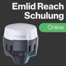
EMLID: Mobile RTK technology
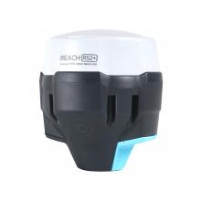
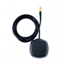
EMLID offers mobile RTK receivers that can provide extremely precise positioning data in real time. In this kit you will receive the EMLID Reach RX. Unlike its predecessors, the EMLID Reach RX does not rely on WiFi or LoRa communication, but uses Bluetooth Low Energy (BLE) to connect to the smartphone.
Pix4D: Advanced photogrammetry software
Pix4D is known for its powerful photogrammetry software, which makes it possible to create detailed 3D models and maps from aerial and ground images. The software offers advanced image processing, analysis and visualisation capabilities that are invaluable for various industries such as construction, agriculture, environmental monitoring and mining.
Advantages of the combination
- Precision and accuracy: By integrating RTK data from EMLID and Pix4D's advanced algorithms, users can create highly accurate geo-referenced models. RTK ensures centimetre accuracy, which is particularly important for applications that require high precision.
- Flexibility and efficiency: Users can take advantage of both online and offline processing options, which facilitates use in different environments and under varying conditions. The mobile solution makes it possible to capture data directly on site, integrate information, and process it via a cloud platform. This increases efficiency and enables rapid decision-making.
- Advanced analysis and visualisation: Pix4D offers advanced functions for analysing and visualising the collected data. These include volume calculations, elevation models and orthomosaic maps. The software also supports augmented reality (AR) for CAD overlays, which facilitates the integration of 3D models into the real world and promotes team collaboration.
Workflow
- Capture accurate and geo-tagged data using your smartphone, the Pix4Dcatch app and Emlid Reach RX for RTK precision.
- Upload your scans to PIX4Dcloud. Your images are automatically processed in the cloud and converted into measurable results using photogrammetry algorithms.
Areas of application
- Construction: Accurate surveying and monitoring of construction sites in real time.
- Utilities: Documentation of underground supply lines.
- Agriculture: Field mapping and analysis to optimize cultivation.
- Environmental monitoring: Monitoring of nature reserves and monitoring of environmental changes.
- Mining: Mapping and monitoring of mining areas and deposits by determining the stockpile volume.
- Urban planning: Creation of detailed 3D models for the planning and management of urban spaces.
- Accident reconstruction: Creation of precise 3D collision scenes and detailed measurements in real time.
- Drone mapping: Supplementing drone mapping with terrestrial data for objects hidden from drone view.
Product characteristics
- Kit dimensions: 365x210x95mm
- Kit weight (with Reach RX and plastic case): 1.1kg (2.4lb)
- Bottom thread: 5/8" female thread
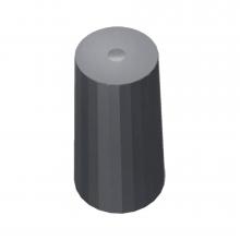
- Handle material: Polyamide 12
- Handle weight: 175g (0.38lb)
- Handle dimensions: 200 x 119 x 36mm
Compatibility
- iPhone (iOS version 16.0 or higher) - The iPhone 15 Pro is recommended
- Phone cases compatible with SPC+ SP connect.
- Handle can be adopted for right and left hand usage.
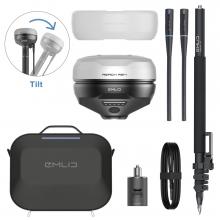
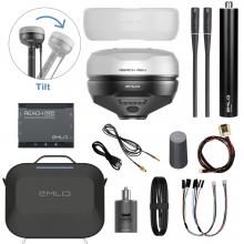
Delivery Content
-
EMLID Reach RX receiver
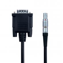
- Type-C USB cable
- Scanning kit:
- EMLID handle
- Leash
- Allen key 3mm
- Carrying bag
- Software as annual license:
- PIX4Dcatch (includes 500 credits for cloud processing)
- PIX4Dcatch online training
Note
- Delivery does not include iPhone and protective case. The protective case can be purchased separately. The protective case requires an SP connection for use in conjunction with the EMLID handle.
- Additional cloud processing credits are available from PIX4D if required.